Our journey to discover Great Basin National Park – One of the most beautiful national parks in Nevada
Travel your wayOur journey to discover Great Basin National Park – One of the most beautiful national parks in Nevada Lauren turned 43 today. She got a dozen yellow roses, a set of turquoise earrings in the shape of hearts and a book, Marcus Aurelius’s Meditations. Birthday cakes were in short supply so we settled for donuts at the grocery store in Nephi. She had an apple fritter with no... Our journey to discover Great Basin National Park – One of the most beautiful national parks in Nevadaadmin
Travel your way
Our journey to discover Great Basin National Park – One of the most beautiful national parks in Nevada
Lauren turned 43 today. She got a dozen yellow roses, a set of turquoise earrings in the shape of hearts and a book, Marcus Aurelius’s Meditations. Birthday cakes were in short supply so we settled for donuts at the grocery store in Nephi. She had an apple fritter with no candle. I’m glad to be married to someone who doesn’t freak out about aging. None of this 30 and holding bullshit.
Today was a long drive to the middle of nowhere. The last bit of civilization was Delta, Utah where we filled up on gas and stopped for a library/playground break. Then it was “Next Services 88 Miles” as we pulled past the last Delta gas station. “Next services” happened to be the Border Inn Casino, which sits on the Nevada-Utah border with a surprisingly cheap gas station given the remoteness, a motel, and a casino. When US-50 enters Nevada, it earns the moniker, “The Loneliest Road in America” as its another 63 miles to the town of Ely, Nevada. We hung a left shortly after the Border Inn Casino for the town of Baker, Nevada with its 2020 census population of 36.
We are staying at the Whispering Elms Motel and RV Park. The office is a bar open between the hours of 4 and 7 PM each day, though the sign notes that it is local dependent. If the locals are still partying hard they’ll stay open later. Perhaps the signage is a holdover from previous eras when there were more people to party hard. The 2010 census listed 68 people. Given Baker’s nearly complete dependence on tourism at Great Basin National Park, I suspect the pandemic has something to do with the population plunging by 47 percent.
We arrived before 4 PM and had to call a cell phone on the bulletin board for the campground manager to meet us. Dakota, a short guy with long blond hair tinged in blue came out a moment later to help us navigate the 100-feet between the bar and our campsite. He was wearing a black t-shirt with cartoon pigs on it with the headline that said “Eat the Rich” and questioning “why should this little piggy have roast beef when this little piggy has none.”
The t-shirt was the first of numerous little quixotically left-of-center imagery of Baker, Nevada which sits in a county that voted for Trump by a margin of around 60 percent. At the Bristlecone General Store, just a short walk from the campground, someone has stenciled BE N onto the ice vending machine so that it spelled out BE NICE. The post office had a bulletin board with all sorts of little “help each other out” themes.
Strangely, no one seems to be FROM Baker. Dakota and his blue-haired wife moved here from Salt Lake City. Rachel, a clerk at the general store is from Portland. Liz the proprietor of the Stargazer Inn and Bristlecone General Store is the spouse of the superintendent up the hill at the national park, but she bought the store in anticipation of her husband retiring here as he wraps up his final years with the national parks service.
Arriving too late in the day to visit the national park we visited the only playground in town which is attached to the local elementary school. Someone had enough sense to realize that the elementary school can function as a public park and the gates are all open to a pretty sizeable playground area and two basketball hoops. Considering the reported population of 36 people and looking around the playground, it is comically large. If you consider every single swing, slide, monkey bar, climbing rig, and spring rider, the entire town could come out and have their own piece of playground equipment. So far, we have seen only two other kids, one belonging to the campground manager and another who was visiting the kid of the campground manager. I am guessing that some of the ranches nearby also send their kids to school here as the town of Ely is so far away.
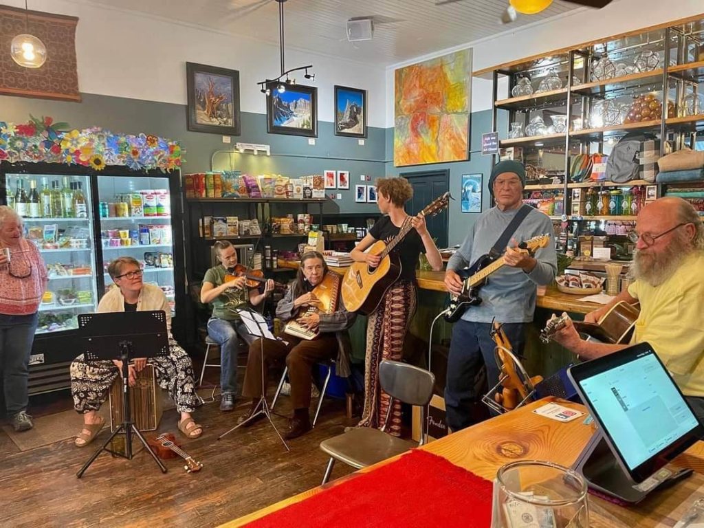
The general store had live music in the form of a six-person picking band. They called themselves the Front Porch Pickers, though due to unknown weather, they squeezed inside the store making it for a crowded evening. Lauren attended and said they were wonderful. This was their seasonal debut. I held things down in the campground to give her time to herself.
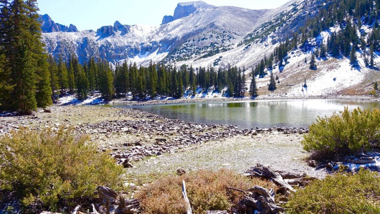
Great Basin National Park takes its name from a large geographic area that spans most of Nevada, and parts of Oregon, Idaho, Wyoming, Utah, California, and Baja California. It is a “basin” for the fact that high mountains on all sides result in rivers flowing into the region but never escaping. These rivers that never make their way to an ocean are known as endorheic. However, given the overall dry climate, there are few lakes in the region, the Great Salt Lake being the largest by far. Other notable lakes include the Salton Sea which we saw during our time in the Imperial Valley back in January. Another notable area that we have been to is the Badwater Basin in Death Valley which occasionally hold seasonal runoff.
The actual national park only makes up a tiny fraction of that area and includes a small portion of the Snake Mountain Range with Wheeler Peak reaching more than 13,000 feet in elevation. The same forces that have made this part of the Great Basin have also lifted up what was once a shallow sea leaving behind several limestone caverns, one that can be explored on a guided tour.
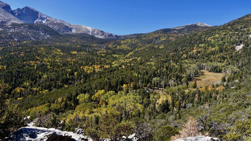
There are two visitor centers but the primary visitor center in Baker is closed until mid-May. The second visitor center up in the mountains is a five-mile drive from our campground and rests on the edge of Lehman Caves, the most accessible of the caves in the park. The visitor center was focused almost entirely on the cave systems and the boys enjoyed taking visitor center provided flashlights to “explore” a 10-square-foot mockup of what the cave looked like.
While Lauren was talking to the rangers about what was open, I took the boys on a .3 mile loop trail that went past the natural entrance of Lehman Caves and provided some pretty amazing views of Wheeler Peak which still has a heavy coating of snow. Lauren booked a 90-minute cave tour in the afternoon for Wolf, Bear, an Me which I accepted with some trepidation over Bear’s bladder. She neglected to mention that tomorrow there was a one-hour tour but what the heck… Children under 5 are not allowed so Lauren would stay back with Lynx.
After the visitor center, we took a hike up Lehman Creek which can summit Wheeler Peak. The mountain with an elevation is 13,065 feet is arguably the largest peak in Nevada as its only competitor Boundary Peak is a subsidiary peak of another mountain just over the border in California. However, we only made it about half a mile before the snow got too deep to traverse easily. This was disappointing because I had hoped to summit the peak tomorrow.
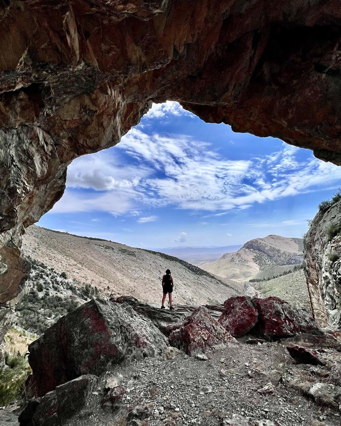
Reports further up the trail from people with snow shoes and poles made me accept that a summit in trail shoes was virtually impossible. Ah well. We’ll add this to the short list of things we want to come back and see some other time. Hiking at around 7500 feet on Lehman Creek, we had another realization about the effects of elevation. If Bear is more prone to whining and angry outbursts, Wolf is more prone to preying on his younger brother with pranks like snowballs down shirts. He has truly sadistic and obnoxious streak that comes out when he is tired or fatigued. Elevation gives us both of those variables. Lynx just passes the fuck out. He fell asleep in the pack within minutes of getting out of the car.
Back in camp in between our hike and the cave tour, Lauren and I had what I am going to call Thai Ceviche. It’s a recipe that I have been perfecting for some time now that takes equal parts shrimp, grapefruit, and avocado and douses it with Thai chili sauce. Then it’s eaten with tortilla chips. Thai Ceviche sounds better than shrimp-avocado-grapefruit salad. It’s fun to make as it involves pulling the individual segments of grapefruit apart. I am sure there is a better technique than what I am doing but I manage okay.
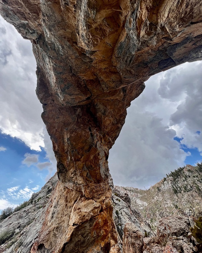
We went back up the mountain a second time for the cave tour. This is our fifth cave of the trip; I have to say that if looking for formations, this cave is better than any of the others. The sheer diversity and number of formations over the course of 90 minutes was incredible. Most people know about stalactite and stalagmites, but a lesser-known formation is the cave shield which forms by capillary action from crevices in the rock.
Over time a large flat surface comes out from the wall, seemingly held up by nothing. Carlsbad Caverns has approximately 30 cave shields. Lehman has more than 500. However, Lehman is a fairly tight squeeze compared to a place like Carlsbad which is why Lynx wasn’t allowed. There is just too much of a chance that a small child can snag a 10,000 year old formation passing through and break it off. It’s tough to be claustrophobic in a place like Carlsbad with its large vaulted ceilings and an underground room so vast that the walkway takes an hour. Lehman requires a lot of ducking underneath overhangs and sudden drop offs on the concrete path. If you don’t like tight spaces, avoid it.
The kids were fairly well-behaved drawing some snickers over an interaction with the ranger when Bear said he had a question. The ranger had just gone through a light lecture on mineral content and cave formation.
“Some rocks have iron in them!”
“That’s right and when we see cave bacon formations later on, you’ll see some of that iron.
Wolf in a deadpan voice loudly said, “that’s a statement, not a question Bear.”
Bear’s bladder ended up not being an issue, though I carried a small Nalgene just in case. He did however start to get clingy about 50 minutes in, a sign that he was tired. I ended up carrying him for much of the return, no small feat is I duckwalked under obstructions with one hand guarding his head from impact. Wolf was also starting to get bored and stomping around, occasionally splashing people in the pooled water. We got out just in time with Bear saying he needed a bathroom 9 minutes before our scheduled exit.
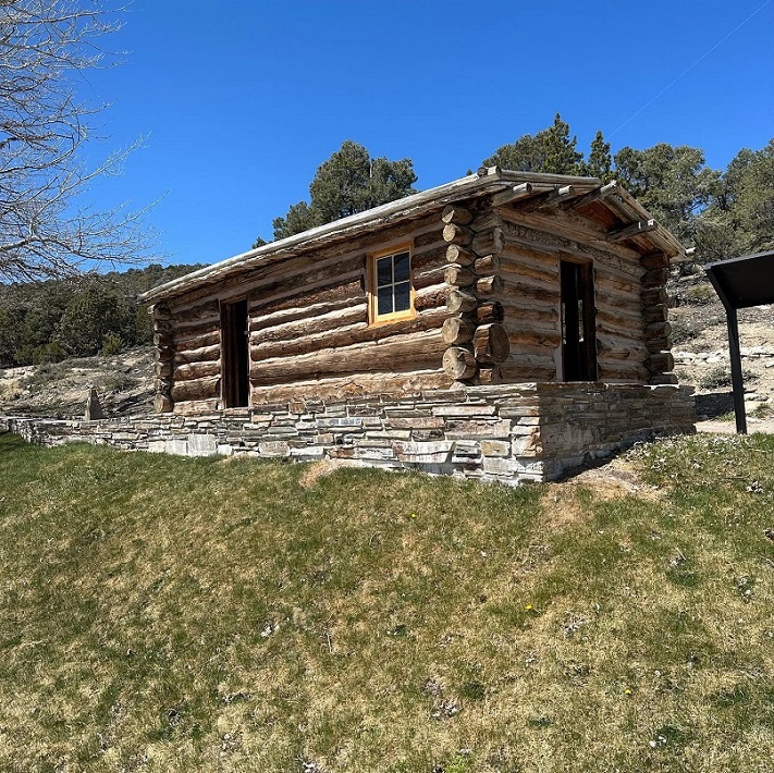
Lauren was ready for us when we returned and we went to the playground a bit. The afternoon was free time for everyone as Lauren and I took turns at the store and the campground bar. I cooked a Red Baron pizza purchased at the bar using their pizza oven and the kids actually ate it. We’ll add that to the short list of things we can feed them when we get to Tallahassee. We haven’t had much luck with frozen pizza in the past.
In the evening, we tried to go stargazing. Baker, Nevada is trying to achieve dark skies designation. To achieve this status, they have to have all interior lights shielded from view and exterior lights covered by a dome so they only point straight down. With only 36 people in town, this seems like it would not be a great big lift.
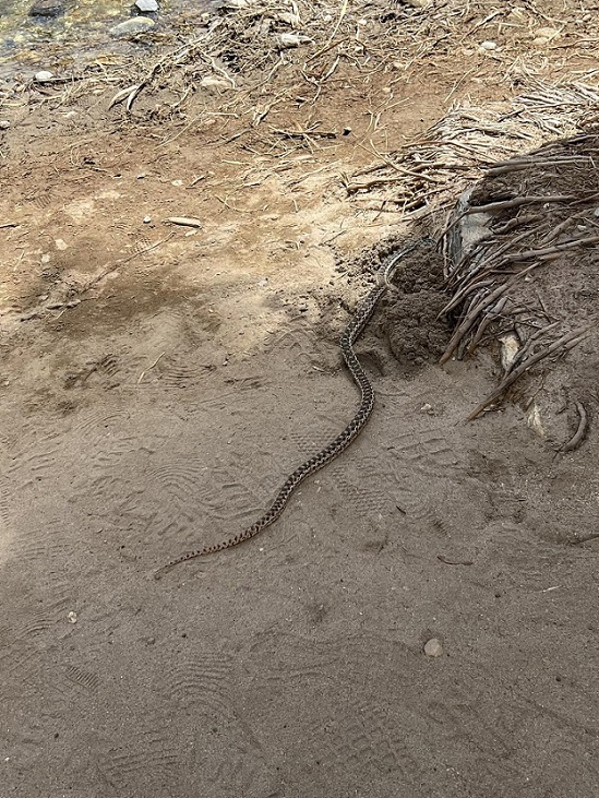
However, we learned from Liz at the general store that when counting all of the immediately adjacent ranches and shanties, the number climbs to 131. This makes policing light more difficult. Our stargazing trip was not a great success due to cloud cover and a half moon. However, we did try out the time and date website which has an interactive map of constellations based on direction and time. We identified one new constellation of Gemini and went through the list of known constellations that we could find before giving up for the night.
In the morning we headed back up the mountain for some delicious breakfast burritos at the café that is attached to the visitor center. The clerk behind the counter was as interesting as everyone else we’ve met in Baker thus far and spends her spare time growing many of the vegetables that find their way into the breakfast and lunch menu at the café. We were the only people in the café but when I peeked in yesterday afternoon, every indoor table was filled and a few people were eating outside. They must do good business during the main season that starts in a few weeks.
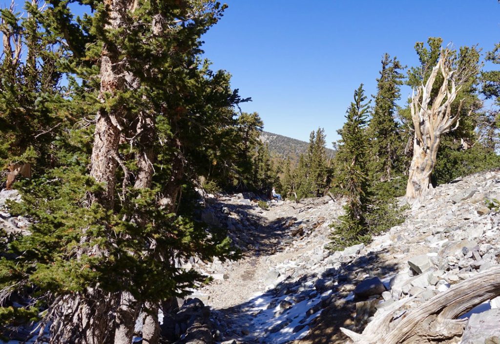
Our first hike of the day was along Pole Canyon which paralleled an overflowing creek for as far as we cared to hike. It wasn’t a particularly special hike but we enjoyed it. The kids played several ill-fated games of Pooh stick watching their sticks quickly getting tangled in the downed trees and brush that made small dams in the water. I learned a new tree called single-leaf pinyon pine.
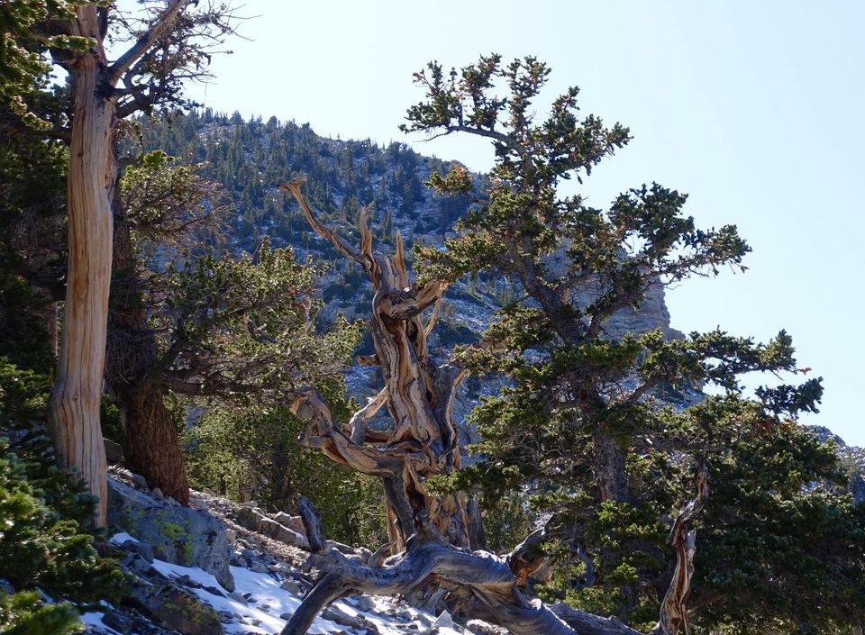
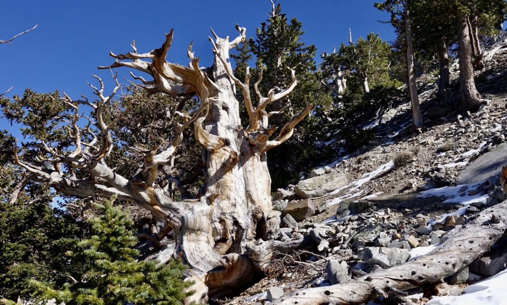
It is unique with only a single needle rather than a clump of two, three, or five needles which is normally the case for pine trees. (Many other conifers such as spruce and fir have single needles which made me spend several minutes contemplating what kind of strange fir I was looking at.) Unfortunately, we were not able to see the most famous trees of the park which are bristlecone pines. Despite their small stature, they are among the oldest living things on earth. (A bristlecone near Bishop, California is the oldest living thing at well over 4,000 years old.)
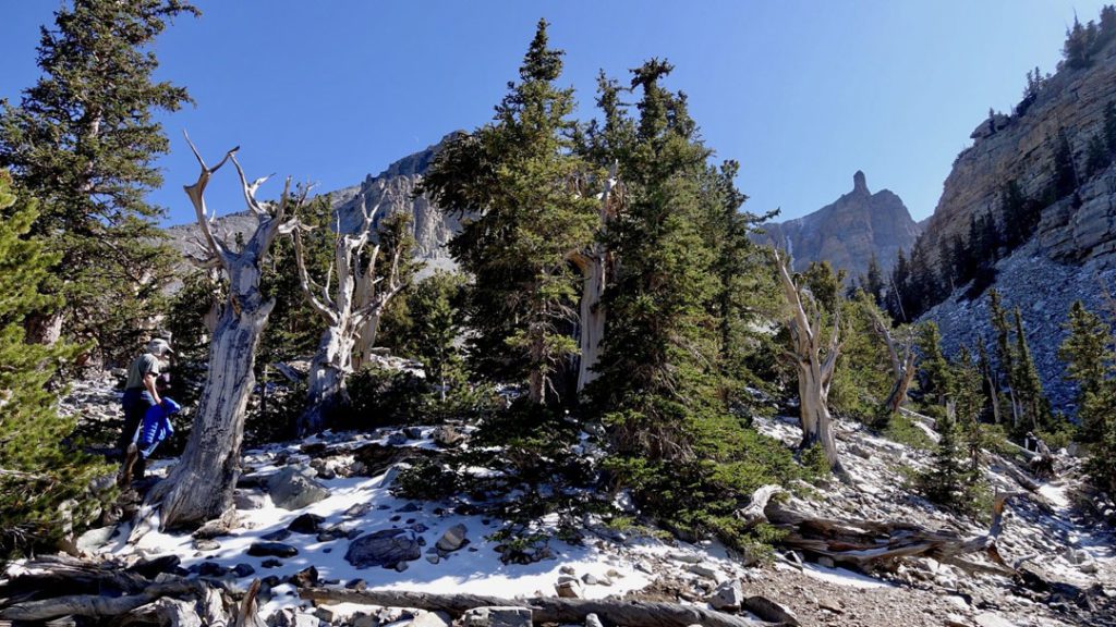
In the afternoon, we enjoyed an informal trip to Crystal Peak which is roughly a 45-minute drive from Baker into Utah and across BLM land via numerous gravel roads. Liz and her off duty park-superintendent husband were our guides and had spoken with Lauren the day before giving her fairly good directions on how to find our destination.
As you approach it, Crystal Peak stands out among all the other mountains due to the nearly complete lack of vegetation and a light gray color that is caused by ancient volcanic ash. Apparently, the peak is actually the wall of an ancient and very large caldera, though the rest of the caldera wall is lost to geologic forces. Google maps seemed utterly confused on how to get to the destination, so we followed Liz’s directions and watched Google Maps give us alternative directions that varied anywhere from 55 minutes to 90 minutes depending on where it thought we were and where it thought we wanted to go.

We passed a turnout that looked like it was in proximity to the peak, but went a little bit further for Google to direct us down a non-existent road. We circled back to the turnout and went on a short hike through the brush to a low pile of rocks to get a better vantage point. We did not see any other people and decided to go back the way we came about half a mile to an area that looked like good bouldering. Just as we were pulling out, a convoy of five or six vehicles rolled up with Liz included. We had stumbled into exactly where we were supposed to be.
After a brief lunch, we started out in a loose group spread out over about 200 meters. Out kids were in the lead, scrambling up the caldera to the point that it started to be unsafe. In their defense, the climb is irresistible. The relatively soft ash has been carved continuously by the wind leaving pockets that act almost like steps, Though the mountain is mostly bare, it is sparsely dotted with small plant life that cling to whatever they can. Among these were Indian paintbrush, the first one Liz had seen this season as she excitedly noted. The route of the group was to go around the caldera and up a canyon for a one-way distance of about two miles. In the canyon is a chance to find fossils from an extinct sea bed. With four miles round trip on top of our morning hike, we begged off, staying with the group long enough to get a good discussion of flora before we turned back to do more bouldering.
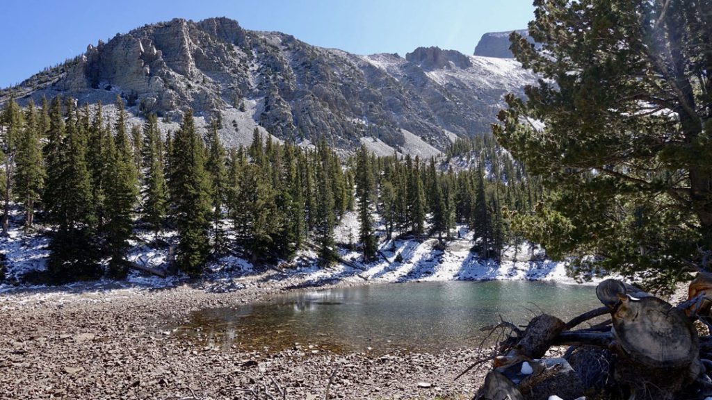
Wolf and Bear were urging us to climb all the way to the top. Not even considering we had not packed any water with us and their misunderstanding of just how big a feat that would be, there was a geology lesson for them. From a wind pocket that had collapsed, I retrieved a cinder block-sized chunk of ash and tossed it down the cliff face. It shattered in a manner of Quikrete that has had too much water mixed in.
“Look, we probably could climb it but that instability is concerning. We’ll come back when you are older with some ropes and try it then.”
This is the third thing on the boys’ collective bucket list after ascending the tallest dunes in Great Sand Dunes and Death Valley National Park. I admit climbing Crystal Peak does look like fun. The boys bouldered for a while longer and we made our way back toward Baker.
About halfway back to Baker, we saw a large four-legged critter maybe a mile in the distance. We stopped, put up the binoculars and it was a pronghorn. It was trotting in our general direction and we were in no hurry. We waited until it approached within a quarter mile and just stared us down. Not coming any closer, we decided to press on at a slow speed. It immediately started doing the four-legged bound that pronghorns are known for, paralleling us. We stopped. It stopped. We started. It started. This went on for several iterations. It never really got close enough to interact but clearly wanted to stay with us. The only theory that makes sense is that there are cattle on the BLM land and our truck looks like a work truck. I imagine that when rangers come out with supplemental feed, the pronghorn probably show up for scraps. If it were autumn, I would just blame it on hormones. I’ve seen male whitetail attempt to breed with sedans and charge headlong into vehicles they perceive to be a threat. I would assume that pronghorn are just as ridiculous, but the rut isn’t until September.
As amusing as our game of red light green light was, life is hard out here and I didn’t want to prolong her interaction and waste the silly beast energy anymore. I accelerated to the point that I felt safe on the gravel road. At 35 I looked over and it was still with us. Then 40, still with us. Then I hit a cattle guard the wrong way and we went airborne crashing into a ditch. The pronghorn moved in and murdered us all because it was a cartel pronghorn. (Okay, that’s bullshit but everything up until the cattle guard was true.) With a sustained speed of 40, it finally fell away and we slowed back down. What a strange interaction.

We stopped at the state line to get just enough gas to move south in the morning. It’s cheaper as we move south. The casino was uninteresting, nothing but slot machines. When I went into the bathroom a large older lady was at a machine. When I came back out, a large older man was at the exact same machine in some sort of matrix glitch.
I ran back from the state line for roughly 8 miles in hopes of doing a 9-minute average pace. This was a tough goal given that we were around 6,000 feet above sea level, just shy of 90 degrees, and a headwind most of the route. My first three miles were fine and then I hit a wall. The wind stopped blowing briefly and I realized suddenly just how hot I was. I scaled back and trudged in with an average pace of 11 and some humility. I am not as tough as I would like to be currently.
Story by Steven Specht
Our journey to discover Great Basin National Park – One of the most beautiful national parks in Nevada
admin


